Construction progress you can measure, flown every month.
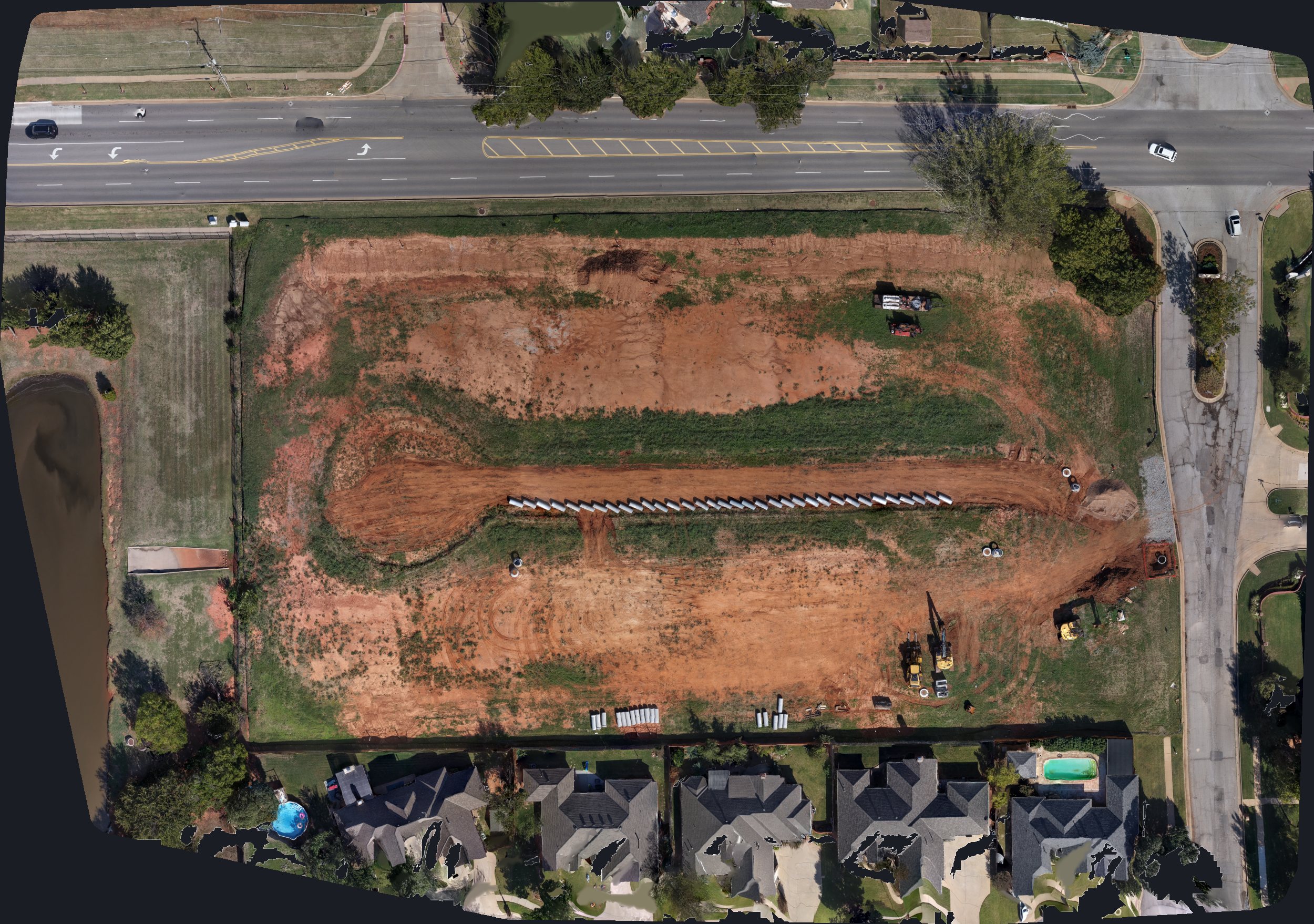
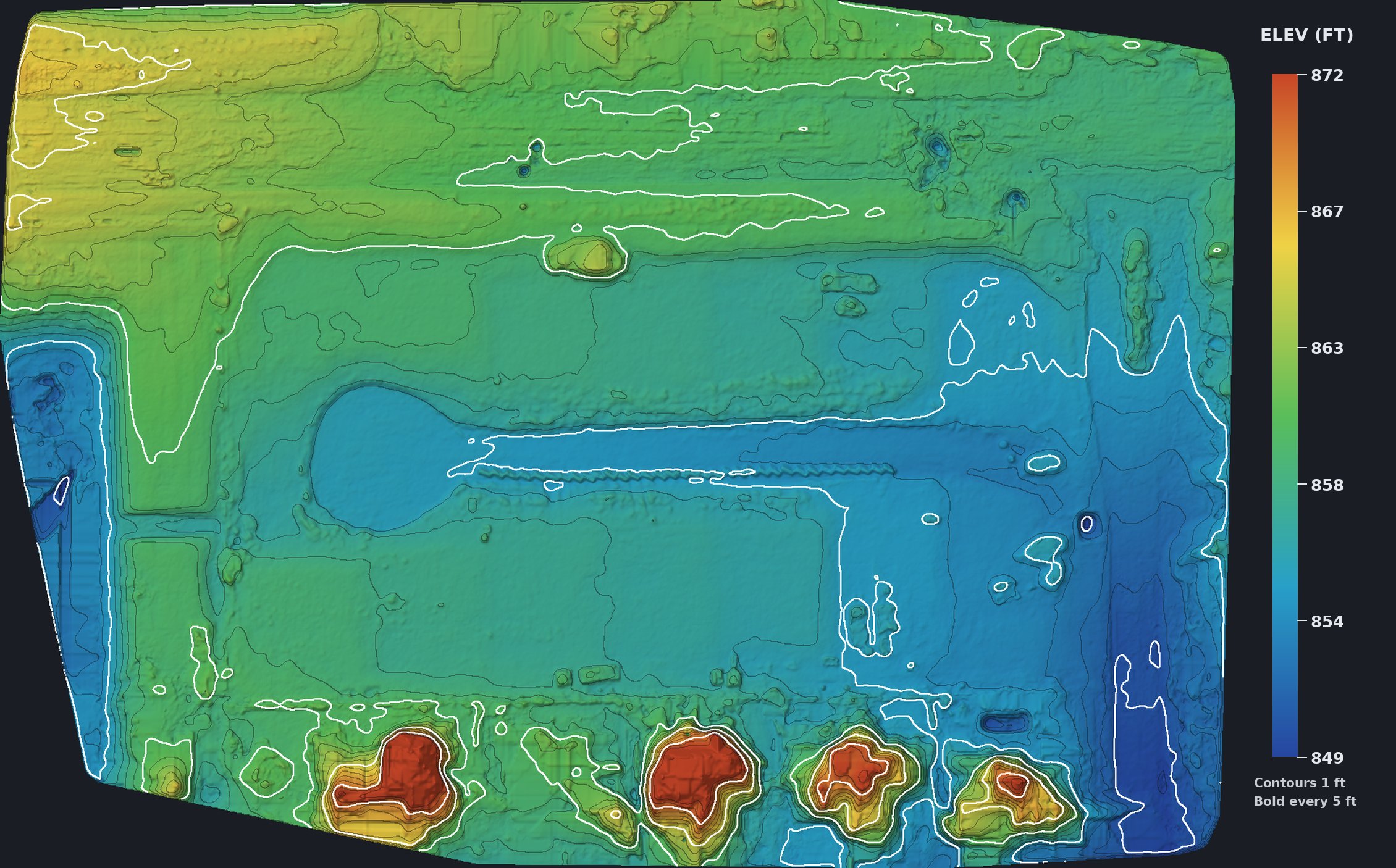
I fly your job site on a schedule and turn each flight into a 3D model, a stitched top-down map and a contour surface, so you can see what moved, how much dirt went where and how the site really looks today without driving out to walk it.
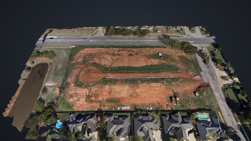
Edmond, OK development site, October 2026. Spin it, zoom in on the storm line and the equipment, and see the grading from any angle.
- 8.7 acmapped
- 23 ftrelief
- 1 ftcontours
- 5 cmdetail
Orthomosaic
Topo and contours
What builders get
Monthly progress captures
I fly the same site on the same plan each month, so every capture lines up with the last one and you can compare them side by side.
Cut, fill and stockpiles
Volumes come straight off the surface model, so you can check dirt moved against the plan and keep an honest count on stockpiles.
As-built record
Utilities, pads and grades are captured before they're buried or paved over, and you keep that record for the life of the project.
Shareable links
Owners, lenders and subs open the 3D model and maps in a browser, on a phone or a desk, without installing anything.
Each flight comes back with a GeoTIFF orthomosaic, DSM and DTM elevation models, contours at the interval you need and a textured 3D model, in formats your engineer, superintendent or GIS person can open. I'm an FAA Part 107 pilot based in Edmond, so sites around the OKC metro are a short drive and easy to keep on a monthly schedule.
Built for
- Home builders and developers
- Site and dirt work contractors
- Civil engineers
- Owners and lenders tracking draws
How it works
- Send me a pin for the site and tell me how often you want it flown.
- I check the airspace, set a repeatable flight plan and we agree on the scope and cost before the first flight.
- After each flight you get the model, the maps and the contours, plus a link you can pass to anyone on the project.
Mapping starts at $400 and 3D models start at $350, and I'll quote a monthly rate for your site before I fly.
Put your site on the schedule
I'm based in Edmond and fly Oklahoma City, Edmond and across Oklahoma. Tell me about the job and how often you want it captured, and I'll get back to you the same day.
Call or text 405-883-FIRE (3473) hello@shoutfire.com