Topo maps of your land, flown from above and ready for your engineer.
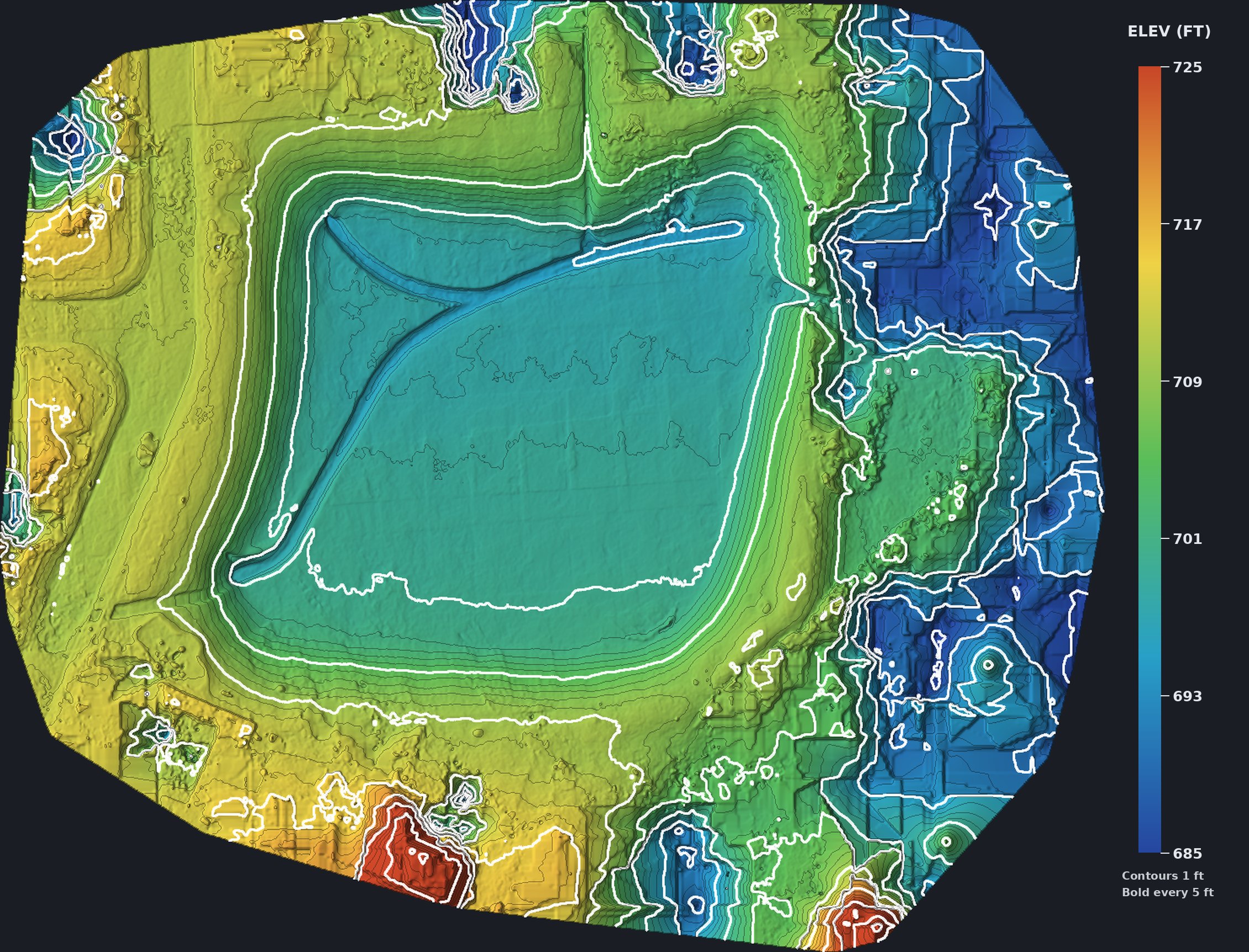
I fly your acreage, pond or job site and turn a few hundred overlapping photos into an elevation model, contour lines and a measurable top-down map. It's a fast way to see how the ground actually lies before you grade, dig, build a pad or price out dirt work.
Licensed and vetted
FAA Part 107 certified remote pilot since 2017 and a Droners.io Approved Pilot. My aerial work has been licensed for CNBC's The Deed and ran as a lead image in National Geographic Travel.
What you get
Contours
Contour lines at the interval you need, delivered as a layer you can drop into CAD or GIS.
Elevation model
A DSM or DTM GeoTIFF so you can read the grade anywhere on the site.
Orthomosaic
One stitched, georeferenced top-down image of the whole property.
Volumes
Pond, cut and fill, and stockpile volume estimates from the surface model.
Most of what I fly is land around Edmond and the OKC metro, so the questions are practical ones: where does the water go, how much dirt comes out of that pond, and does the lot fall the way the plans say it does. A drone map answers those faster than walking it with a level, and you keep the files.
This is mapping-grade work that's built for planning and design conversations. When a project needs a stamped boundary or a certified survey, I'll fly the site and hand the data to your licensed surveyor so they can use it alongside their own control.
Built for
- Landowners planning a pond, pad or drive
- Builders and site contractors
- Civil engineers who need a quick existing-conditions surface
- Ranches and acreages
- HOAs tracking drainage areas
How it works
- Send me the address or a pin and tell me what you're planning.
- I check the airspace and the weather, and we settle the scope and cost before I fly.
- You get the elevation model, contours, orthomosaic and any volumes you asked for, in formats your engineer or GIS person can open.
Topo mapping starts at $400, and I'll confirm the total for your site before I fly.
If conditions aren't safe to fly, I'll reschedule instead of pushing it.
Get on the schedule
I'm based in Edmond and fly Oklahoma City, Edmond and across Oklahoma. Tell me the site and what you need, and I'll get back to you the same day.
Call or text 405-883-FIRE (3473) hello@shoutfire.com